

Erythraei
Sive Rubri Maris Periplus Olim ab Arriano Descriptus
45.5 x 35.5 cm copperplate engraving, 58 x 47 cm sheet size, modern hand colour, Antwerp, engraved 1597, printed 1624
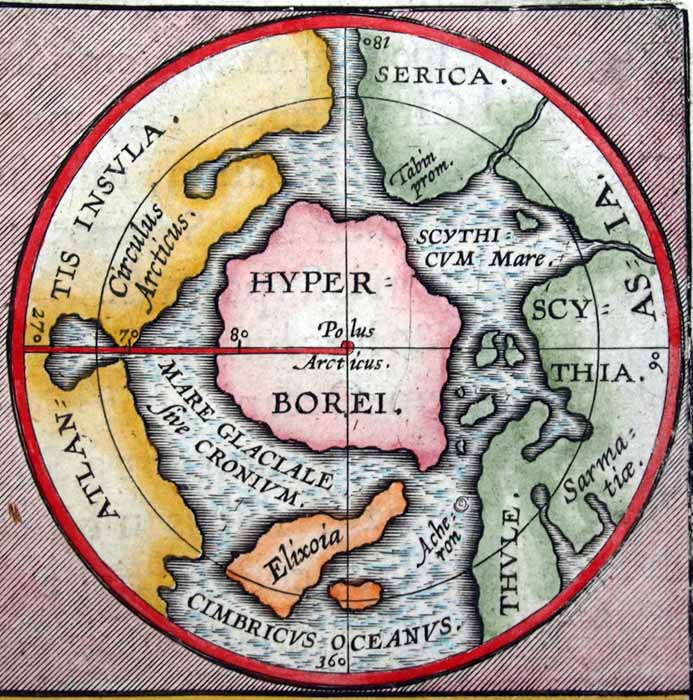
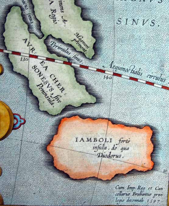
We are pleased to offer this scarce original map from the Theatrum Orbis Terrarum of Abraham Ortelius (1527-1598), the first true atlas in the modern sense. This example of "historical cartography" was presented in the Parergon section of the Theatrum, where Ortelius notes that his historical maps "are published separately from the Theatrum, where places are shown as they are in the present day" and that he "includes them as a supplement at the instigation of friends." No matter the self-effacing introduction, it is evident that Ortelius put far more personal effort into the maps of the Parergon than the "present day" maps of the Theatrum which in most cases were entirely composed by other cartographers. One of the most unusual of Ortelius maps, the principal map is based on the Indica of the historian Arrian (Flavius Arrianus, 86-146 AD) and charts the northwest coast of Africa, the Arabian Sea, India and the Bay of Bengal with a barely recognizable Malaysian Peninsula and Sumatra - all as it was known to the ancient world around the first century of the Common Era. Twin circular inset maps separately chart the cities founded by the Carthaginian explorer Hanno on the African coast beyond the Strait of Gibraltar and the north polar region with a speculative polar continent. Finally, a beautifully engraved and richly detailed inset map charts the wanderings of Ulysses in the Mediterranean. This 1624 printing was issued by Balthasar Moretus (1574-1641) publishing just the Parergon maps as a separate work.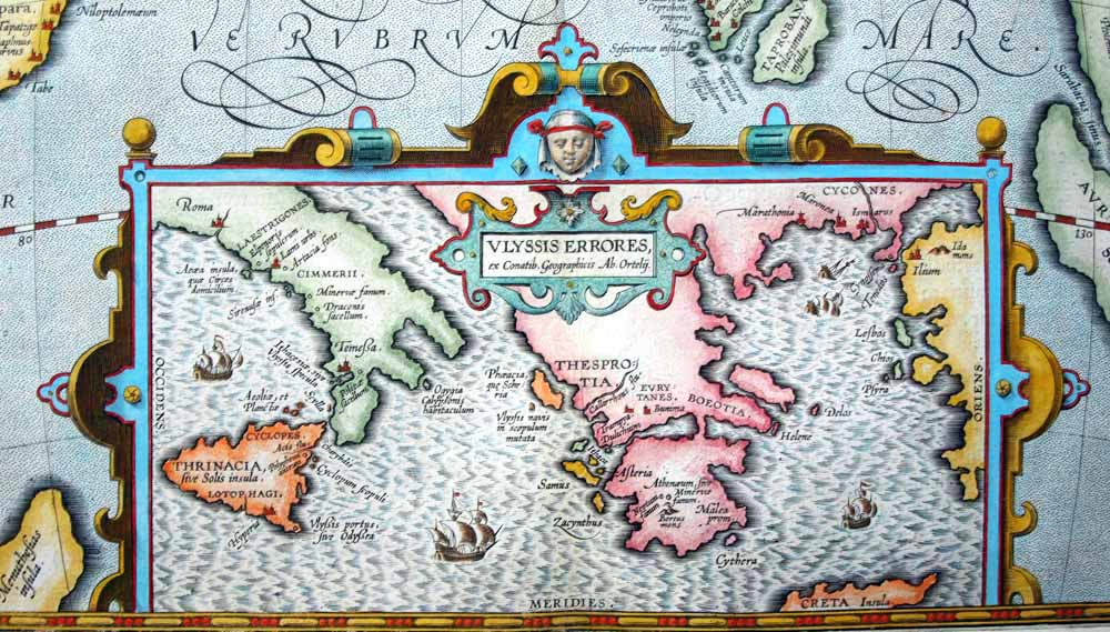
| Description | |
Erythraei
Sive Rubri Maris Periplus Olim ab Arriano Descriptus
45.5 x 35.5 cm copperplate engraving, 58 x 47 cm sheet size, modern hand colour, Antwerp, engraved 1597, printed 1624
We are pleased to offer this scarce original map from the Theatrum Orbis Terrarum of Abraham Ortelius (1527-1598), the first true atlas in the modern sense. This example of "historical cartography" was presented in the Parergon section of the Theatrum, where Ortelius notes that his historical maps "are published separately from the Theatrum, where places are shown as they are in the present day" and that he "includes them as a supplement at the instigation of friends." No matter the self-effacing introduction, it is evident that Ortelius put far more personal effort into the maps of the Parergon than the "present day" maps of the Theatrum which in most cases were entirely composed by other cartographers. One of the most unusual of Ortelius maps, the principal map is based on the Indica of the historian Arrian (Flavius Arrianus, 86-146 AD) and charts the northwest coast of Africa, the Arabian Sea, India and the Bay of Bengal with a barely recognizable Malaysian Peninsula and Sumatra - all as it was known to the ancient world around the first century of the Common Era. Twin circular inset maps separately chart the cities founded by the Carthaginian explorer Hanno on the African coast beyond the Strait of Gibraltar and the north polar region with a speculative polar continent. Finally, a beautifully engraved and richly detailed inset map charts the wanderings of Ulysses in the Mediterranean. This 1624 printing was issued by Balthasar Moretus (1574-1641) publishing just the Parergon maps as a separate work.

The inset map of Ulysses' wanderings (Errores) assigns locations for various episodes of the Homeric account, all presented in an ornate "frame":

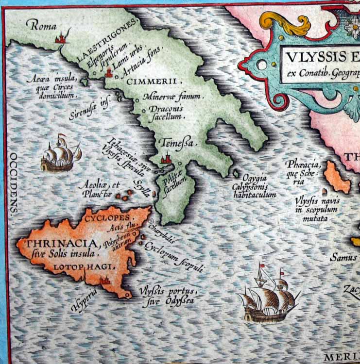
Looking more closely at the inset map, we find Aeaea, the island of Circe, located south of Rome with the Islands of the Sirens closeby. Sicily is home to the Lotus Eaters and the Cyclops while Ogygia, home to the nymph Calypso is found near the "boot" of Italy. In a charming anachronism, Ulysses is depicting as sailing in a 16th century Dutch galleon:
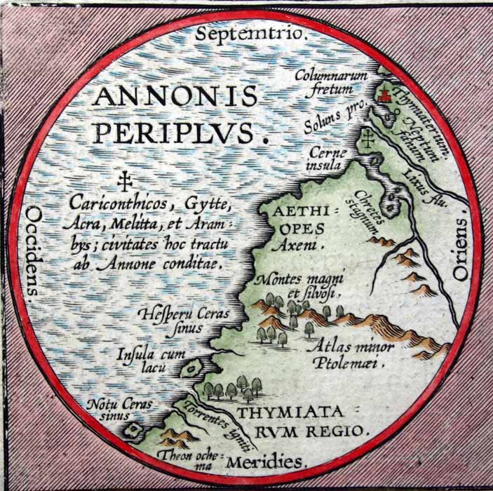
Many of the ornate cartouches used by Ortelius' engravers were taken from a series of ornament prints published in the 1560s by the brilliant architect, painter, designer and graphic artist Hans Vredeman de Vries - here Ortelius notes that the region was earlier described by Flavius Arrianus (Arrian) and expanded upon by Ortelius in this presentation:

| Description | |
Erythraei
Sive Rubri Maris Periplus Olim ab Arriano Descriptus
45.5 x 35.5 cm copperplate engraving, 58 x 47 cm sheet size, modern hand colour, Antwerp, engraved 1597, printed 1624
We are pleased to offer this scarce original map from the Theatrum Orbis Terrarum of Abraham Ortelius (1527-1598), the first true atlas in the modern sense. This example of "historical cartography" was presented in the Parergon section of the Theatrum, where Ortelius notes that his historical maps "are published separately from the Theatrum, where places are shown as they are in the present day" and that he "includes them as a supplement at the instigation of friends." No matter the self-effacing introduction, it is evident that Ortelius put far more personal effort into the maps of the Parergon than the "present day" maps of the Theatrum which in most cases were entirely composed by other cartographers. One of the most unusual of Ortelius maps, the principal map is based on the Indica of the historian Arrian (Flavius Arrianus, 86-146 AD) and charts the northwest coast of Africa, the Arabian Sea, India and the Bay of Bengal with a barely recognizable Malaysian Peninsula and Sumatra - all as it was known to the ancient world around the first century of the Common Era. Twin circular inset maps separately chart the cities founded by the Carthaginian explorer Hanno on the African coast beyond the Strait of Gibraltar and the north polar region with a speculative polar continent. Finally, a beautifully engraved and richly detailed inset map charts the wanderings of Ulysses in the Mediterranean. This 1624 printing was issued by Balthasar Moretus (1574-1641) publishing just the Parergon maps as a separate work.

The inset map of Ulysses' wanderings (Errores) assigns locations for various episodes of the Homeric account, all presented in an ornate "frame":

Looking more closely at the inset map, we find Aeaea, the island of Circe, located south of Rome with the Islands of the Sirens closeby. Sicily is home to the Lotus Eaters and the Cyclops while Ogygia, home to the nymph Calypso is found near the "boot" of Italy. In a charming anachronism, Ulysses is depicting as sailing in a 16th century Dutch galleon:

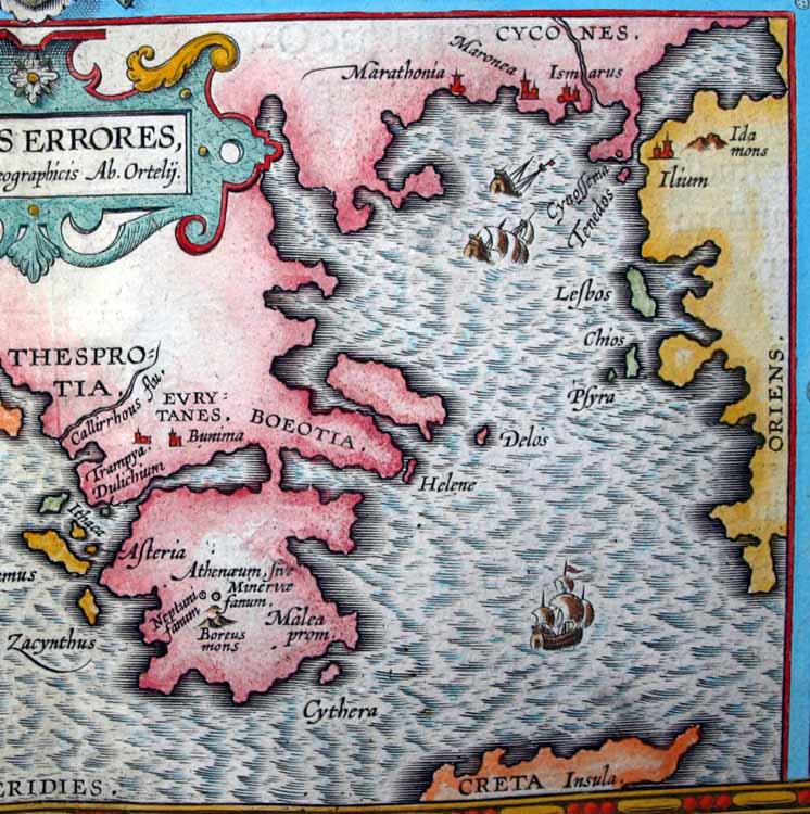
Tiny
shipwrecks dot the Aegean - to get a sense of the detailed engraving
work consider that the tiny ship at bottom measures just 12 mm from the
top of its mainmast to the waterline:

Many of the ornate cartouches used by Ortelius' engravers were taken from a series of ornament prints published in the 1560s by the brilliant architect, painter, designer and graphic artist Hans Vredeman de Vries - here Ortelius notes that the region was earlier described by Flavius Arrianus (Arrian) and expanded upon by Ortelius in this presentation:

The Punic text from the Periplus of Hanno describing Hanno of Carthage's journey beyond the Pillars of Hercules (Strait of Gibraltar) and the establishment of the cities shown on this inset map can be found here: And Hanno the Navigator is even the subject of a recent Al Stewart song!

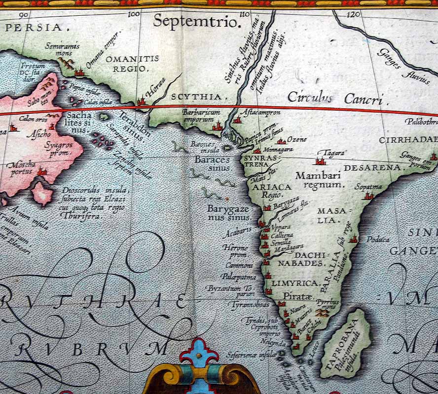
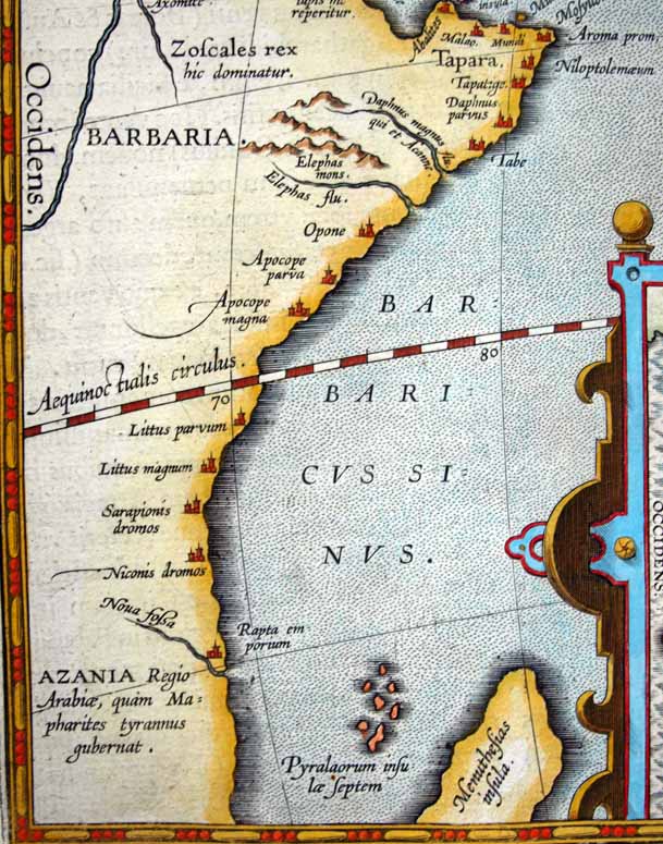
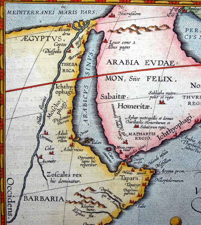
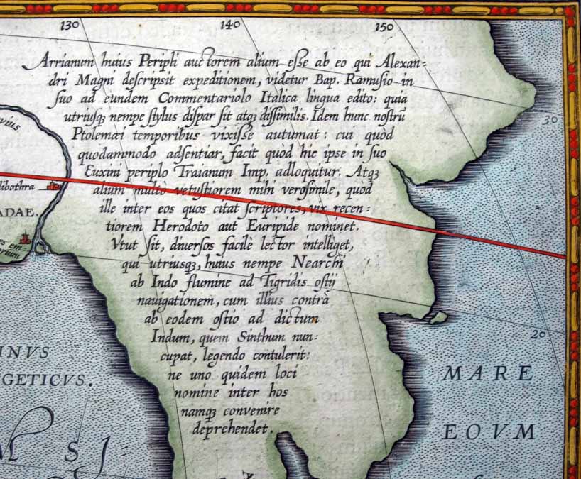
A lengthly inscription discusses Arrian and the Indica: "It seems to (Giovanni Battista) Ramusio that the Arrian who is the author of this periplus (Indica) is not the same as the Arrian who wrote about Alexander the Great's expeditions. [Flavius Arrianus] Writing in Italian Ramusio observes that their styles of writing differ significantly. He also thinks this Arrian likely lived in the time of Ptolemy, to which I somewhat agree as he addresses his writings concerning the Black Sea to the emperor Trajan. [Traianus] The other Arrian cites authors of the era of Herodotus and Euripides and seems much older. Whatever the case may be, the reader can discern that one of these two Arrians navigated from Nearchus at the Indus River to the mouth of the Tigris and from there back to the Indus which is also called the Sinthum as is shown on the map." In fact Ramusio and Ortelius were confused - there is only the one Arrian. Ortelius was correct to place the author of the Periplus as contemporary with Ptolemy (circa 83-161 AD) since Arrian (circa 86-146 AD) and Ptolemy were in fact near contemporaries but Ramusio's sole basis that the style of writing in a short report of a circumnavigation of the Black Sea in traditional periplus format would by definition be different than his sweeping histories. Ortelius mentioning the report to the Emperor Trajan - here is where the two renaissance scholars went wrong. It was in fact addressed to Trajan's successor Hardrian (thus placing everything in the right period) - Hadrian's official title was Imperator Caesar Traianus Hadrianus Augustus and Arrian omitted the last two names. Moreover, the Indica was written in a somewhat stilted Greek style emulating that of Herodotus while Arrian's better known work on Alexander the Anabasis Alexandri was written in the clear and direct style of Xenophon - thus leading Ramusio to believe there were two Arrians.
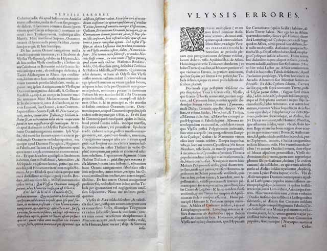
...I side with Isaac Tzetzes that the Lotus Eaters dwelt near Hyperia, a city in Sicily... and am not persuaded that they resided in Africa as many ancient historians say. It is apparent in Homer himself that the following day after leaving the land of the Lotus Eaters they came upon the Cyclops, which is so far remote from Africa as opposed to Sicily as to be impossible... This I thought, dear reader, to admonish should seek in vain for such location in Africa on our map...
...They came unto the Laestrygones, a savage people that used to eat men just as they now write of the cannibals of America...
...It was the wine of Maronea wherewith Ulysses did make the great lubber Polyphemus drunk as Euripedes in his "Cyclops" also insists, with the wine of Maronea as celebrated and famous as any other wine in the world...== Early index == Main map index == Glossary == FWP's main page