SOUTH AND SOUTHEAST ASIA, 1603
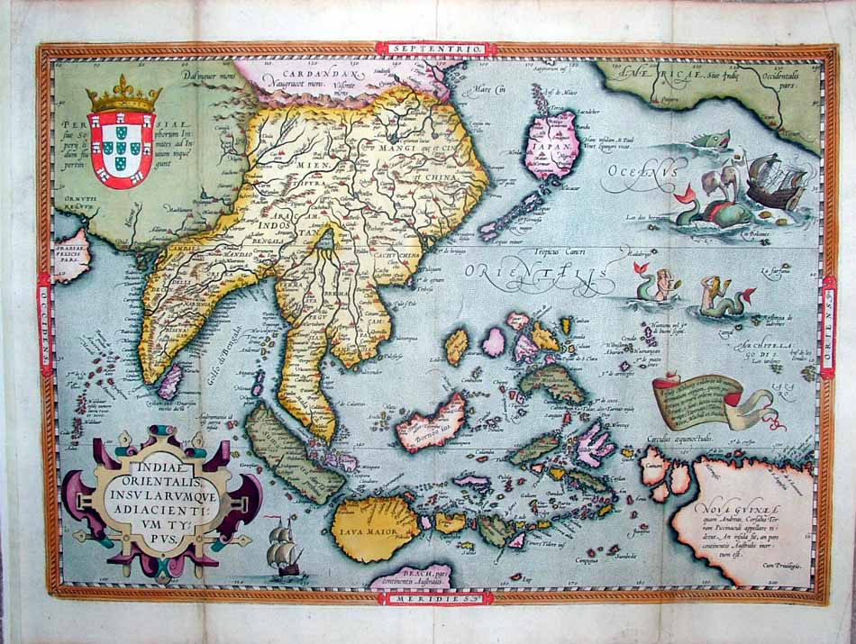
SOUTH AND SOUTHEAST ASIA, 1603

"Indiae Orientalis, Insularumque Adiacientium Typus," from the Theatrum Orbis Terrarum of Abraham Ortelius, 1603 Latin edition
The seller, *regiomontanus*, provides useful commentary that is reproduced here with only slight editing:
"This scarce and important original map of East Asia (49.5 x 35 cm copperplate engraving, 54 x 40.5 cm sheet size, later hand colour, Antwerp, circa 1603) comes from the 1603 Latin edition of the Theatrum Orbis Terrarum of Abraham Ortelius (1527-1598), the first true atlas in the modern sense. It was one of the most famous and influential maps published in the Theatrum. Ortelius drew upon earlier maps by Mercator, as well as the accounts of Marco Polo and Antonio Pigafetti, a survivor of Magellan's circumnavigation. The map provides a fascinating snapshot of a part of the world just starting to be understood in the great age of exploration, and the flamboyant decorative elements understandably make it one of the most celebrated and sought-after of all Ortelius maps.
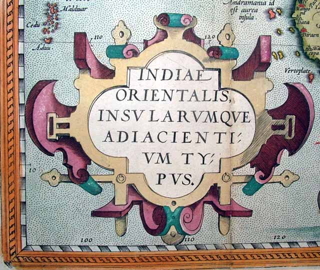
The handsome title cartouche announces the region described as the "East Indies and surrounding islands." Many of the ornate cartouches used by Ortelius's engravers were taken from a series of ornament prints published in the 1560s by the brilliant architect, painter, designer and graphic artist Hans Vredeman de Vries:
We begin our survey of the map with the kite-shaped Japan introduced by Mercator -- the plate for the map was engraved in 1570, and it is interesting to compare it to the *Ortelius map of Japan engraved 25 years later* to see how rapidly European knowledge of the region expanded in the last quarter of the 16th century:

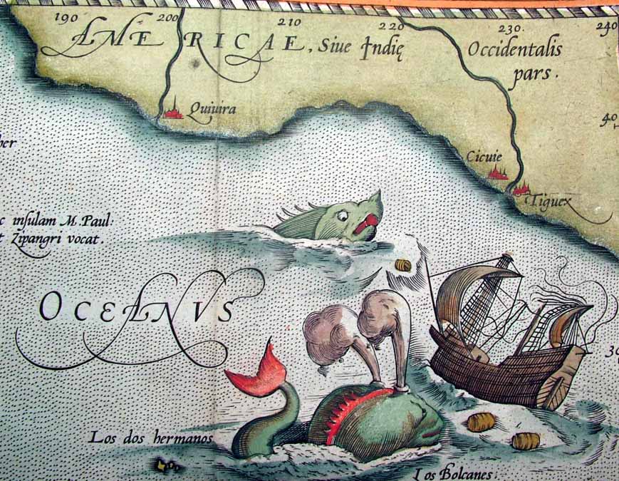
Two fearsome sea monsters attack a disabled ship off the shore of America, which is shown in close proximity to Japan:
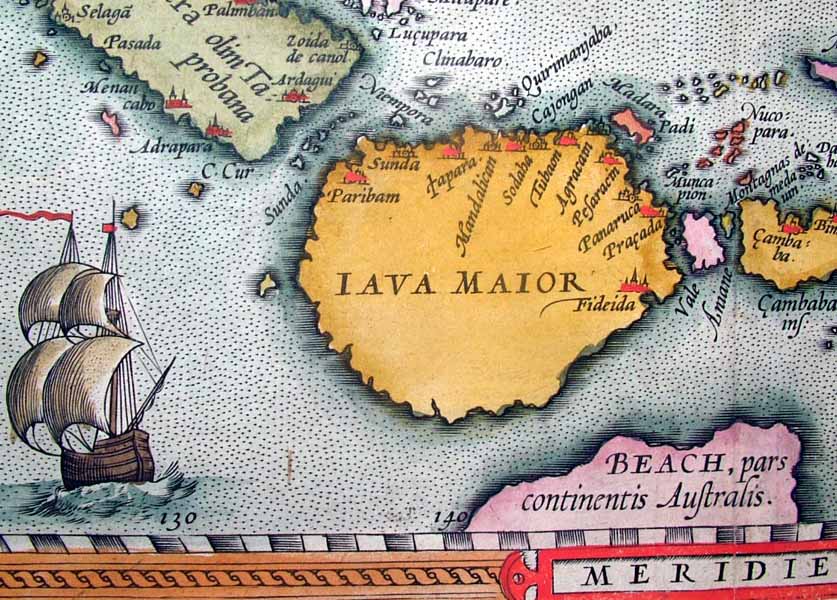
Note the Ptolemaic great southern continent of "Beach" below Java Major, and a handsome ship:
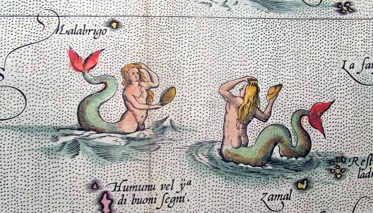
Two mermaids comb their hair with sea-shell hand mirrors:
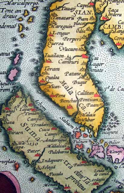
Singapore is shown as "Cincapura", Siam as "Sian" with "Camboia" to the east:
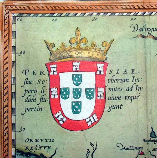
The Portugese arms are presented, symbolic of their dominant influence in the region:
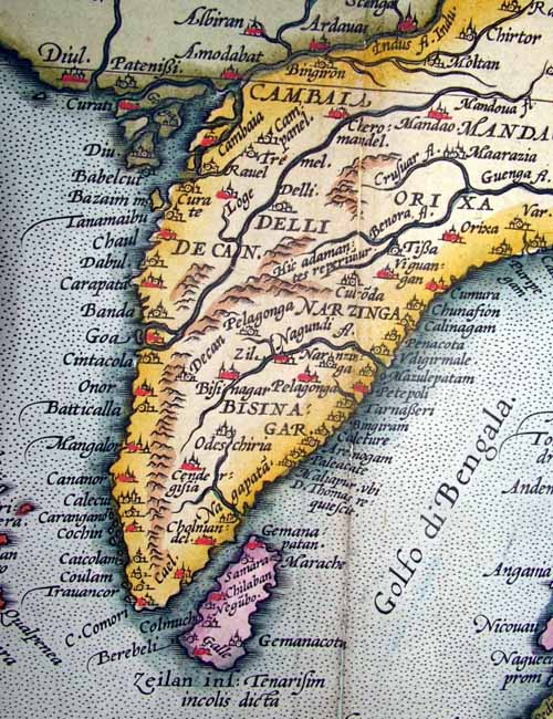
India is mapped with dozens of place-names:
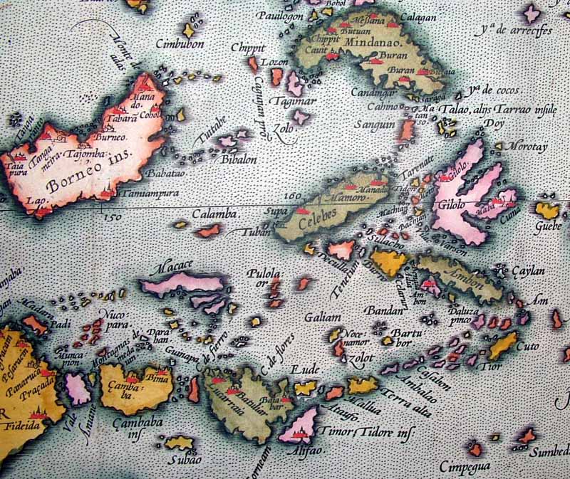
Luzon is missing in the Philippines and all islands are somewhat distorted -- to get a sense of the map's detail consider that the distance from "Manado" on Borneo to "Manadu" on Celebes measures just 6 cm actual size:
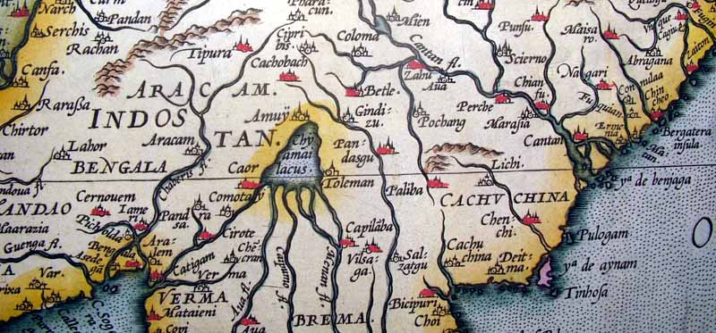
China is shown with no Korean peninsula:

Ortelius follows Mercator in placing the mythical Lake Chyamai northeast of India and showing it as the source of numerous rivers:
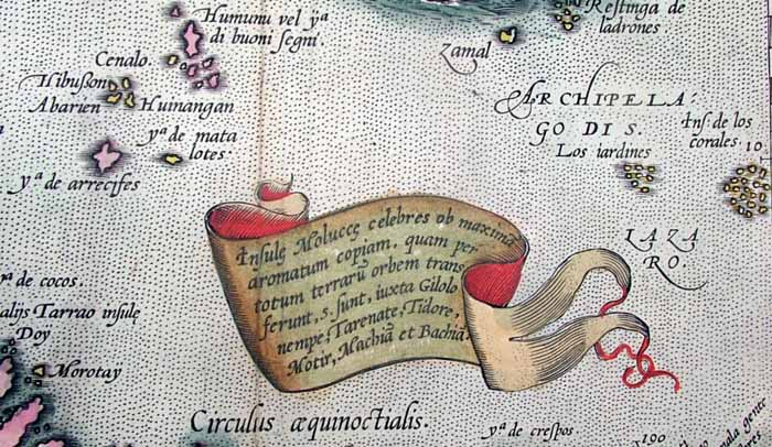
The banner advertises the fact that the Moluccan Islands "export fragrant spices all over the world":
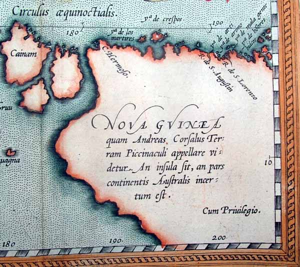
The notation on New Guinea states that "Andreas Corsalus names this land Piccinaculi, and whether it is an island or part of a southern continent is unknown":
Ortelius's commentary is a fascinating document in itself, and so for reference purposes we offer a translation below derived from the 1606 English edition published in London:
Nearly all writers have confirmed by consensus that there is no finer or more famous country in the world comprehended under a single name than that of the name of India. It was so named after the Indus River. The entire compass of India was defined by Strabo and Pliny as being limited by the Indus River in the west, the Taurus mountains on the north, the sea in the east where the famous Molucca Islands are found, and the Indian Ocean in the south. It is divided in the middle by the great Ganges River with the western portion known as India of theInner Ganges and the eastern part known as India of the Outer Ganges. In the Holy Scriptures it is called Evilat or Havila; others call it Seria or the country of the Seres, as Dominicus Niger testifes. Paulus Venetus seems to divide it into three provinces – the Greater, Lesser and Middlemost, which he says they name Abasia.The country is rich and fortunate, and as Herodotus writes, it is the most populous and best stored of any country in the world, with an almost infinite number of towns and villages and great abundance of all commodities (with brass and lead excepted, according to Pliny). It has many great and fair rivers that water its soil, which with a sun of full force is most fruitful. It supplies the world with spices, pearls and precious stones, with a greater plenty of these things than the rest of the world combined.
There are so many islands in this region that it could justly be called the World of Islands. But Japan, which Paulus Venetus calls Zipangri, is worth special note since not many years ago it was known to few or none. It is a very large and wide island, and has almost the same elevation with respect to the north pole as Italy does with the south pole. The inhabitants are much given to learning, wisdom, and religion, and are diligent searchers of the truth in natural causes. They pray and hold services in their churches much in the same manner as Christians. They have one king to whom they are subject and obey all his orders and laws. Yet this king has one above him as well whom they call Voo, to whom the ordering of ecclesiastical matters and governance of the church is committed. This we may peradventure not unfitly compare to the Pope, and their king to the Emperor. To their Bishop they commit the salvation and care of their souls. They worship only one God, portrayed with three heads, yet they can show no reason for this. They baptize their infants and fast as an act of penance in labour of wearing down their bodies. They cross and bless themselves with the sign of the cross against the assaults of Satan so that in certain ceremonies and manner of living they seem to imitate the Christians, but despite the efforts of the Order of Jesuits by all means possible to convert them wholly to Christianity, they resist.
The Molucca Islands are found in this region, famous for the abundance of spices they yield and send into all quarters of the world. The little bird called the Manucodiatta is found here, which we call the Bird of Paradise. Closer to the coast of India is Sumatra – this island was known to ancient geographers and historians as Taprobana. There are diverse other islands here of great fame and estimation, including Java Major and Minor, Borneo, Timor etc. as you can see on the map, but we cannot speak of every one fully
Diodorus Siculus, Herodotus, Pliny, Strabo, Quintus Curtius, and Arrianus in his life of Alexander, have all described the region, as has Apuleius in the first book of his Floridoriam. There is also an extant epistle of Alexander the Great written to Aristotle on the situation of India. Of the later writers Ludovicus Vartomannus, Maximilian Transylvannys, Johannes Barrus in his Decades of Asia and Cosmos Indopleutes, whom Petrus Gyllius cites, have done the same. The epistles of the Jesuits contain much information about Japan, but for a full description I would recommend the 12th book of the Indian History of Maffei. John Macer has written books on India and Java, and the Spaniard Castagendo has done so in the Spanish language. On the scattered islands lying here and there in the ocean the second book of Gonsalvo Ovetani can be read also in the Spanish tongue."
== Mughal index == Main map index == Glossary == FWP's main page