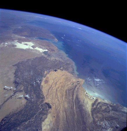

The Indus River and the Makran desert, looking south-southeast from space
Source: http://www.cosmiverse.com/reflib/Image_Gallery/earth/earth127.html
(downloaded June 2001)
Image 127 of 196, Pakistan Pan-Indus River Delta. Credit: NASA Earthrise.
"Two major physiographic features appear in this south-southeast-looking, high-oblique photograph of southern Pakistan--the Indus River and its floodplain and the southeastern end of the complex Makran Mountain Range. The Indus River and its highly cultivated floodplain produce a variety of grain crops and cotton. Annual rainfall varies from year to year and usually does not exceed 20 inches (50 centimeters); therefore, Pakistan, like Egypt with its Nile River, depends on the Indus River for water.The dark Indus River floodplain is bordered on the east by the Thar Desert (Great Indian Desert) and the highly reflective (white) area in India known as the Great Rann of Kutch (large salt marsh); on the west it is bordered by the complex, folded Makran Mountain Range. Karachi (with an estimated 1990 population of almost 10 million), the major port city on the Arabian Sea and former capital, is located along the western edge of the Indus River floodplain. The large peninsula southeast of the mouths of the Indus River is the Kathiawar Peninsula of India, the home of the only remaining Asian lions."

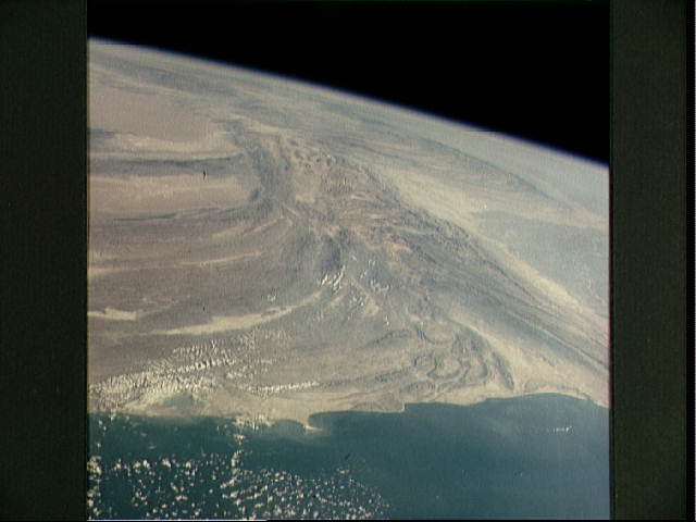
Looking north from Karachi by satellite and seeing the Makran Range
Source: http://www.jsc.nasa.gov/pao/asiapac/pakistan.html
(downloaded June 2001)
"Makran Range of Pakistan. Photo ID: STS002-09-473. A spectacular view of the Makran Range of Pakistan (27.0N, 65.5E) looking north with the Arabian Sea and the city of Karachi in the foreground. In the center, the Indian sub-continent moving slowly north into the Asian continent has caused the folded sedimentary Makran Range to bend from east-west to north-south as well as the uplift forming The Great Himalaya Range and the high Tibetan Plateau to the north."

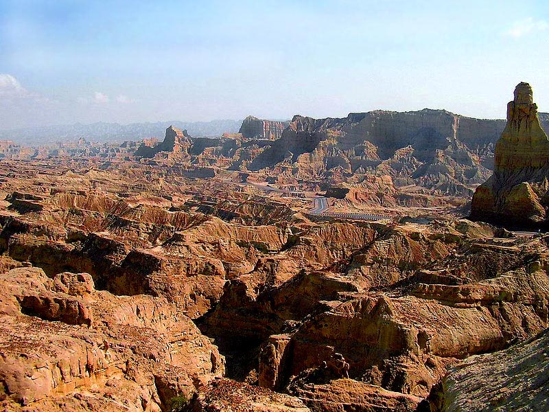
A modern landscape: rocks, and the Makran Highway
Source: http://www.flickr.com/photo_zoom.gne?id=57485052&size=o
(downloaded Sept. 2006)
*"Karachi 244 kilometers" on the Makran Highway*
Source: http://www.flickr.com/photo_zoom.gne?id=78815577&size=o
(downloaded Sept. 2006)

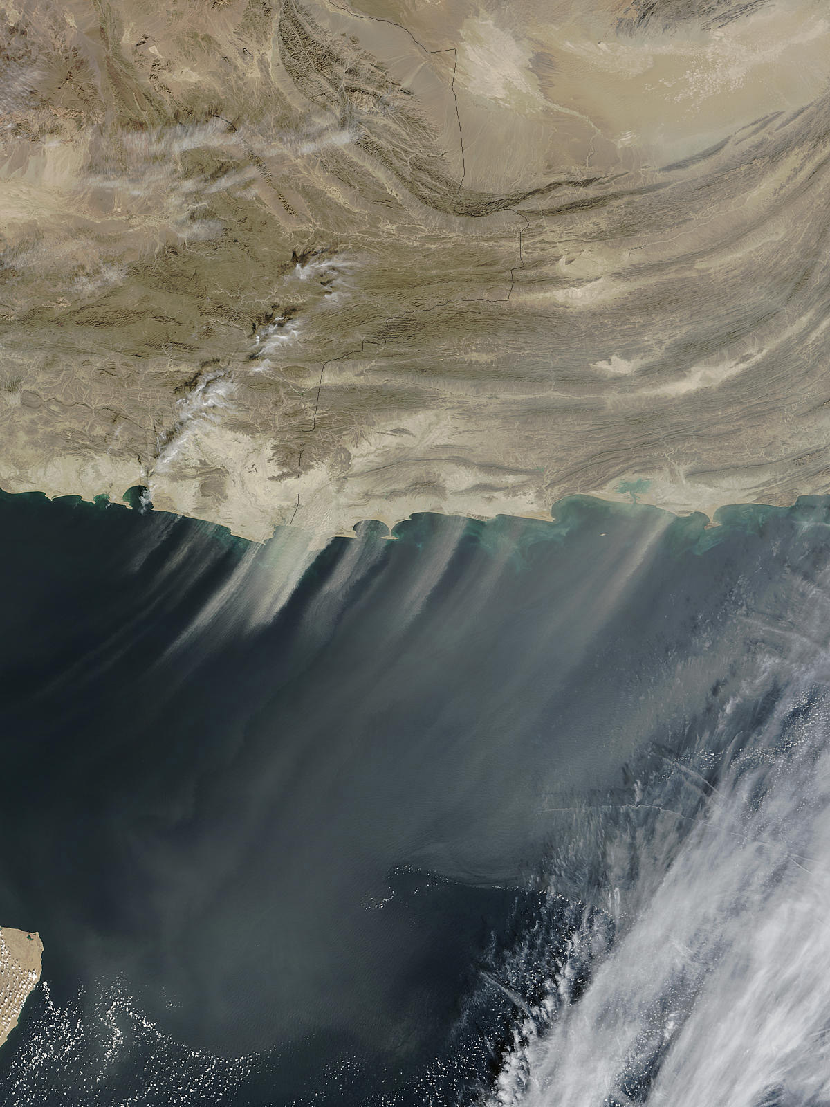
A dust storm in the Makran area, on the Iran/Pakistan border (Nov. 24, 2003)
Source: http://earthobservatory.nasa.gov/NaturalHazards/natural_hazards_v2.php3?img_id=11856
(downloaded Nov. 2004)
"A large storm is blowing thick plumes of desert dust over the Arabian
Sea. The dust is coming from the shores of Pakistan (right) and Iran (left).
The pattern seen in this image is common. Winds often blow down from Makran
Coast Range in Western Pakistan and Eastern Iran into the coastal valleys,
and carry dust out over the Sea."
Source: http://www.dawn.com/2001/03/26/local13.htm |
== Indian Routes index == Indian Routes sitemap == Glossary == FWP's main page ==